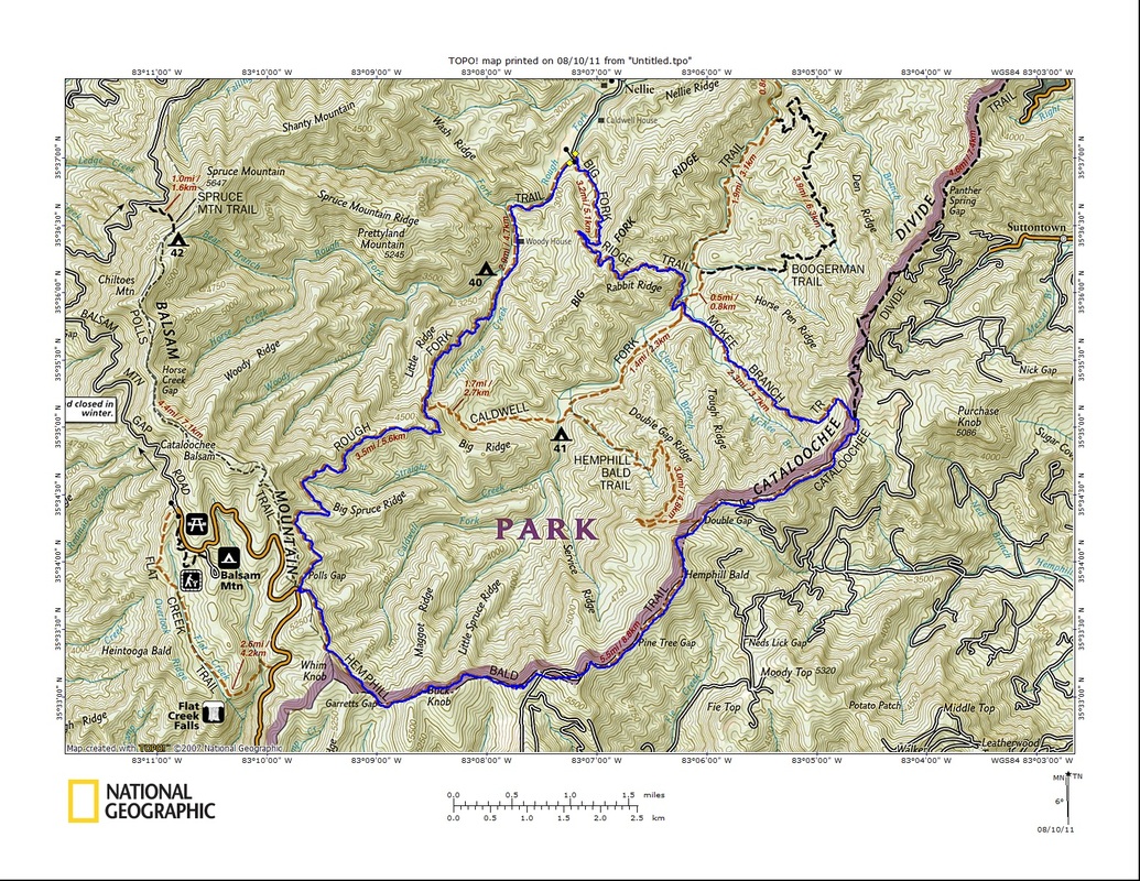
A demanding loop hike that saw me accumulate some new miles in the process of returning to a favorite destination near Cataloochee. 
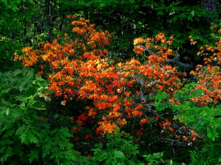
Flame Azalea and Mountain Laurel were out in full force along the Blue Ridge Parkway making for a spectacular drive. 
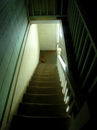
Peering down the staircase inside the old Woody House. 
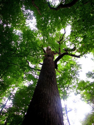
My first ever trip to the depths of Cataloochee. 
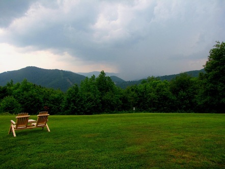
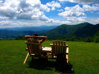
Watching a storm cell pass by a few miles away to the south from the comfort of Gooseberry Knob. 
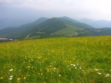
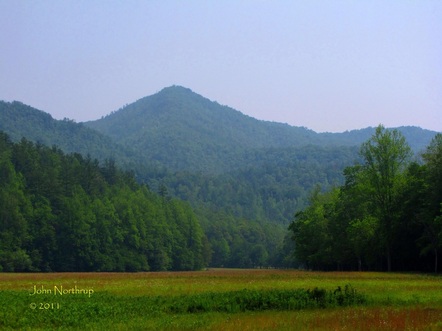
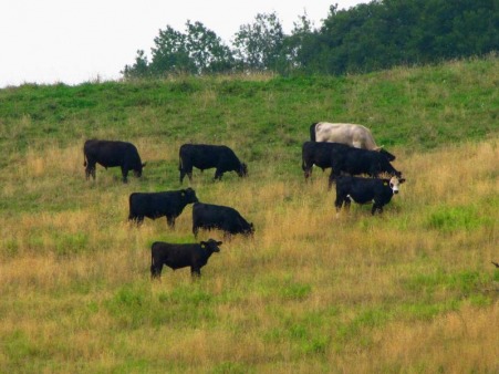
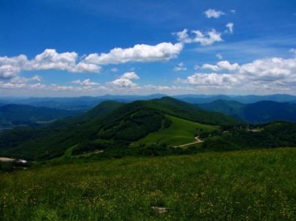
Fields of gold atop Hemphill Bald. 
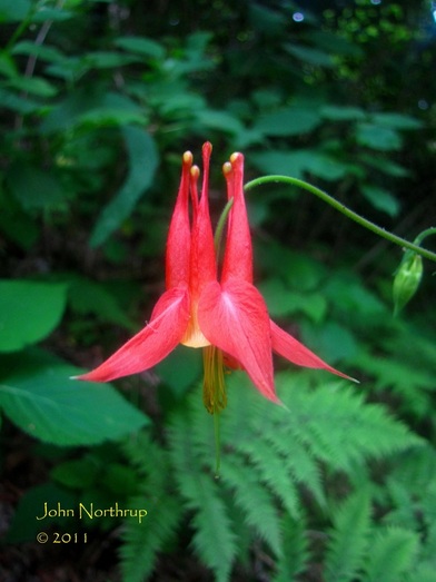
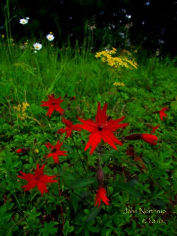
Several patches of Wild Columbine were still blooming strong along the trail back to Polls Gap.
1 Comment
If you remember from my first trip to Hemphill Bald, I was blown away by what I saw and experienced. So of course, I had expectations coming into this hike, a return trip to the bald that would have coming in from the west side. Starting from Polls Gap along the Heintooga Ridge Road, I originally thought I would make a loop hike out Rough and Caldwell Forks and finish off Hemphill Bald, heading clockwise. Since the weather called for a strong chance of afternoon storms, I figured it would be best to reverse my direction of travel and hit the bald in the morning while the skies and views were in my favor. It also meant than I would end my hike on a climb up Rough Fork instead of the level walk across the western portion of Cataloochee Divide. For the first few miles, not much was blooming, a vast change from my hike in early June. Occasionally I would come to small clearings that sported coneflower, pale jewelweed, and turk's cap lilies. Most of the liles had already bloomed and faded, a little disappointing, and a sign of the early summer blooming schedule this year. Once again, I was following a wooden fence the entire way that separated the park from the Cataloochee Ranch to the south. The closer I got to reaching the slopes of Hemphill Bald, I began to see a lot of Fly Poison in bloom, their white and green clusters forming a puffy wand around the stem of the plant. What made my June hike along the Cataloochee Divide so great were all the crazy surprises. The views, the wildlife, the nicely furnished lawn chairs and hammock on a grassy bald. Well, this time it came when I stepped out of the woods and stood face to face with a herd of cattle. I'm not sure who was more surprised to see who. At least we were separated by a small barbwire fence, but I could have reached out and pulled on their ear tags if I wanted. They watched my every move trying to figure out if they should be scared, charge, or just ignore me. It was just so random to see. One expects to see a deer, bear, snake, or bugs, but how often are you looking off into the woods for cattle? Exactly my point. So I chuckled, took some pics, and carried on. I would pass a few more groups of the big black bulls grazing, but most enjoying the shade of the surrounding forest. About a mile before reaching the summit of Hemphill Bald, the ranch opens up into long grassy fields that parallel the trail. Wildflowers also began to appear in bunches as well. Tall bellflower, starry campion, coneflower, red bee balm, turk's cap lilies, great mullein, common buttercup, mountain mint, fly poison, and pale jewelweed crowded the edge of the woods to harness the sun's rays. The swallowtail butterflies were in their glory, moving from bloom to bloom, sometimes two or three sharing one blossom at a time. It took an eternity to reach the summit since I was constantly stopping to take pictures, but I finally managed to get there. The views were much hazier and cloudier compared to the clear blue skies from early June. The bald itself still had some common buttercup gracing the hillsides, but the rest of it was more parched from the sun and appetites of cattle. As I headed down the eastern side of the bald, I took note of more differences from my first trip. There were more of the wildflowers previously mentioned, replacing the flame azalea and mountain laurel that skirted the forest's edge. Due to the grazing cattle and summer heat, the grasses were either eaten or trampled, so they no longer waved in the wind like they did when they were tall, green, and fresh from spring growth. I was still amazed at the site of cattle, constantly looking back up the slopes of the bald to admire the meaty creatures. I soon arrived at Double Gap, but instead of taking the Cataloochee Divide east, I would be looking to complete my loop hike, which meant heading downhill to the south along the remainder of the Hemphill Bald Trail. Immediately after leaving Double Gap, the trail conditions worsened. It was more overgrown in places, the ground muddy and rocky, and the footing treacherous. Since it's a horse trail, it gets destroyed easily and requires some intense maintenance. This section was also entirely downhill, so there were a couple places where I was nervous about taking the wrong step on a loose rock or sliding in the mud. There were no wildflowers blooming, but only the occasional berries from umbrella leaf. It was nice to reach the junction with Caldwell Fork because it meant the horrible downhill was behind me and now I was in for some level walking on a wide path. This section from here to the split with Big Fork Ridge is muddy in places, but much smoother on the feet compared to the rocks and roots of Hemphill Bald Trail. The black and yellow swallowtails were also out in full force, hundreds at a time in their conglomerations on the trail or soaring through the air. When I doubled back and returned to the junction with Hemphill Bald I caught sight of a tall evening primrose. Now I continue on my counterclockwise journey back to Polls Gap. At first the climb is gradual, passing a campsite and crossing some creeks. Before it really starts to climb, their is a sign pointing out two massive tulip poplars. I took the spur trail through the woods to the base of the bohemoths. One was dead and severed in half, for how long I'm not sure, but the closer was still growing strong. Its diameter far greater than my wingspan. Having such large and beautiful trees still flourishing in the park, spared by the logging industries, is such a nice treat. They help put things in perspective in terms of time. Things have been happening here for a long time, well before me or anyone else. They demonstrate the grandeur of the wilderness, but also its delicacy. Their preservation is but a small piece to maintaining the majesty and wonder of the park. When I took a step back, I saw how all other trees dwarfed in comparison, just showing how impressive the mighty tulip is. On my way back to the main trail, I saw a team of three horses heading downhill, their kicking of rocks echoing through the trees. They were most likely headed back to Cataloochee, and too bad that wasn't my direction of travel or a I might have asked one rider for a pick-me-up. Now the climb really started to kick into gear. This section of Caldwell Fork would be the steepest, combined with the fact that the heat and humidity was oppressive. Storms could be heard building in the distance as a result. Along the climb I spotted a handful of black-eyed susans in full bloom as well as some goldenrods.
By the time I reached the junction with Rough Fork, I was a soaking wet mess, the hot air and killer climb the culprits. Unfortunately the climbing for the day was not over, for I still had a mile of steep ascending before it leveled out. After a short snack and water break, the rain started to trickle, but nothing was penetrating the forest canopy yet. Around the time I hit the ridgeline it began to downpour and rainwater was reaching my level. The trail instantly became a river causing me to hop and skip around for better footing that wouldn't soak my boots. I didn't even bother to pullout my raincoat because the shower was such a welcome relief. It's coolness and washing away of the stinky sweat actually made for a pleasant last few miles. I have no pictures from this part of the hike because I packed my camera for its protection, so only visual memories to share. Rough Fork Trail is attached to Balsam Mountain, which is appropriately named, because the majority of this trail that follows the ridge is lined with balsam firs, quite different than most hikes I've been on in the park. As soon as I completed the loop hike and stepped out at Polls Gap, the rain had ceased and the sun shined brightly. What timing! It didn't take long for it to heat up again as well. My drive back down Heintooga Ridge and the Blue Ridge Parkway was pleasant. When I stopped in Cherokee to get some gas, the brief thunderstorm came over and drenched the area. Some cars were hydroplaning in the pourly drained roadways. As soon as entered the park it had ended and the drive over Newfound Gap saw the sun's return. But of course, shortly after I arrived at my motel, another powerful storm hit the mountains, soaking the city and apparently pounding Mt. LeConte with hail. That's summer for ya! June is my favorite month of the year in the Smokies. It's warm, the mountains have fully awakened from their wintery slumber, and the floral displays put on by the flame azalea and rhododendron are at their peak. Since I have all but wrapped up the Tennessee side of the park, the majority of my future hikes will lead me into North Carolina. I haven't been east of Kephart Prong Shelter or south of the AT when it comes to that corner of the park. Today's hike would lead me to the very southeast corner out of the park near Cataloochee. The drive out of Cherokee along the Blue Ridge Parkway was most pleasant. The various overlooks offered exceptional views to the north and south, and the roadsides were occasionally lined with flame azalea and mountain laurel. It was also neat to checkout other mountain towns along the state highways, since I'm so used to the scene around Gatlinburg. Based upon my research, I had high expectations for this hike, perhaps making my most anticipated of the year. I would take the Cataloochee Divide trail from the gravel road at Cove Creek Gap all the way out to Hemphill Bald. Right out of the gate, wildflowers were doing their thing. Flame azalea, spiderwort, bowman's root, fire pink, and goat's beard abound. What's so great about the divide trail is that it follows the ridgeline the majority of the time, so you're constantly feeling the breeze rising up from either Cataloochee to the north or Maggie Valley to the south. This was much appreciated since it kept the bugs away and battled the heat. Since the trail toes the park boundary the entire time, one walks beside an old fence the separates the trail from other trails and roads outside the park. A little over a mile in, I stumbled upon a hillside clearing that dropped a few hundred feet away from the park border. An opening in the fence allowed me an entrance into a field of grasses, oxe-eye daisies, fire pink, yellow ragwort, woodland bluets, yarrow, mountain laurel, and flame azalea. Looking directly across the clearing one saw Purchase Knob, and through the trees in another direction out to the Pisgah National Forest. A small wooden shack with a bench sat atop the clearing with a sign that read "Taylor's Turnaround." Not a bad place to stop and take a break. Pressing onward, the trail had fewer wildflowers to treat the eye, just the same old wooden fence and overgrown roads. When I came to a junction, there was a sign that provided directions along the divide trail, but made no mention of what is in the direction of the unmarked path leading south. It was well trodden, so I followed it in all my curiosity. As soon as I saw a sign that read Science Ed. Center, I realized I had arrived at Purchase Knob. I came out of the woods to an amazing sight. Situated in a gap covered only in tall grasses, there is a research facility that looks more like a cottage with a road that one needs special permission to drive. The trail I took comes out right by a small building that monitors air quality and possesses a web cam that looks out over the gap and into the Pisgah National Forest of North Carolina. Certainly a breath taking view, all the mountains in their shades of green and blue, the cotton like clouds breaking up the sun's rays that danced across the landscape. If you're interested in checking out the current view from the web cam, go ahead and click on the picture below, linked to the park service page. I made my way back to the divide trail and noticed more flame azalea, ranging in color from the reddest oranges to the whitest yellows. After a short time past the Purchase Knob turnoff, one comes to yet another clearing atop Gooseberry Knob. I really got a kick out of this one. As I passed through another break in the fence and out of the woods, I walked out on to a well kept lawn that consisted of an entire mountain side offering grand vistas. Heck, you could see the wheel lines from the lawn mowers. The fun doesn't stop there! Scattered across the bald were picnic tables, wooden lawn chairs, and a gazebo with a hammock!!!!!!!! Who knew you could stumble across such fabulous amenities mid-hike? I couldn't stop laughing in disbelief and smiling in amazement at the great views. I usually don't take long relaxation breaks on my hikes, but I had to enjoy this one. At this point, I knew I was getting close to reaching Hemphill Bald...mostly because I was looking right at it from the comfort of my lawn chair. The summit was several hundred feet up, but the green pasture that was ranch property extended from top to bottom outside the park. When I began to make the climb up the bald, it was an awesome sight to the breeze playing with the grasses, creating ripples and waves that blew up the mountain side. There were few trees, but a large population of mountain laurel bushes stood at the bottom of the climb. The trail itself was becoming rocky and muddy, likely due in part to the horse traffic. When you reach the summit of Hemphill Bald, there is another gap in the fence, big enough only for people, to entire an area that has a lone tree shading a stone table. The park side is completely forested, but the view out over the Cataloochee Ranch is unforgettable. The mountain side is blanketed in grasses and yellow flowers. There is a 180 degree view of endless ridges in their hues of blue and green within the Pisgah and Cherokee National Forests as well as the Smokies. Even though you're in close proximity to civilization below, it doesn't really phase you because the views are so breathtaking. It was tough to leave such a majestic place. For being such a highly anticipated hike, it surpassed all my expectations. It did so well as to climb to the No. 2 spot on my list of favorite hikes behind Gregory Bald, overtaking Spence Field / Rocky Top...for now. That hike will get a chance to reclaim its spot next week when I hope to see the catawba rhododendron, flame azalea, and mountain laurel rocking out in an explosion of color. What a great way to kick off the month of June!
|
Thanks for visiting!I appreciate you stopping by. This site is for your enjoyment as much as it is mine. Look for new photos and journal entries about every 1-2 weeks. Archives
November 2011
Categories
All
|